Walton County has an interesting border history.The continents formed and began to drift. Our Northwest and West section of Florida was probably part of South America while the Florida Peninsula was part of Africa. Walton County would eventually be founded in the West Florida section. West Florida and East Florida are as different today as they were from inception, socially as well as geographically. Ages ago, while Northwest Florida was high and dry, Miami and Tampa were underwater. A rise in sea level may return Florida to this status.
Waterfall in Appalachian Mountains, the source of Walton County's white quartz sand along its South Walton Beaches. This sand forms the southern border of Walton County for about 26 miles. Our barrier islands along the Gulf Coast were formed in the Quarternary period. Barrier islands along the Atlantic were formed in the Pleistocene era per Dr. Carl Froede in email to me. 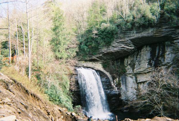
Tree stumps in the water along the beaches of South Walton. The southern border of Walton County was about 40 to 100 miles out 10,000 years ago. See my History of South Walton Real Estate for more information and academic footnotes on this topic.
The shoreline of Walton County's southern border stabilized about 3,000 to 5,000 years ago. This might have been the view natives in the area had. Walton County's southern border of sand dunes are some of the tallest in Florida. Natives would have had an advantage viewing sailing explorers. With the high elevation of Walton County, it is probable that native peoples lived in this area thousands of years earlier. Evidence has been recently found in a nearby West Florida county (Wakulla). 
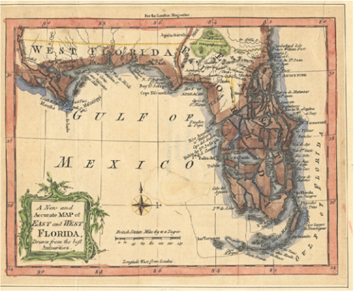
Pope Alexander VI had split the world in half with the Inter Caetera of 1493, giving half to Spain. Then, the Chavez map (see map on Home Page) was published in Ortelius' Atlas of the World in 1584 showing the expansive borders of Florida, the first named state by the Europeans. (before this put about land being native.) Map personal collection from great uncle's museum, T.T. Wentworth, Jr. You can tell most visitors to Florida, "Welcome home to Florida!" See Chavez map on main page.
What is now Walton County was part of the 14th British Colony of West Florida. The British had West Florida and East Florida between the 1763 and 1783 Treaties of Paris. Before and immediately after that, the area that Walton County is now in belonged to Spain. West Florida remained in control of Florida politics until the Voting Rights Acts of 1964. The Florida Legislature was determined by counties not population before that. When Governor Andrew Jackson left Florida to return to Tennessee, he instructed East Florida secretary in St. Augustine to run documents through George Walton, Jr. of Pensacola, Acting Governor and Secretary for West Florida and Territory of Florida. Map - Brenda Rees collection from great uncle's museum - T.T. Wentworth Jr. Florida State Museum
See academic paper by Brenda Rees "The History of South Walton Real Estate" for border history footnotes. Vertical Divider
|
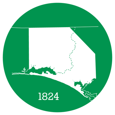
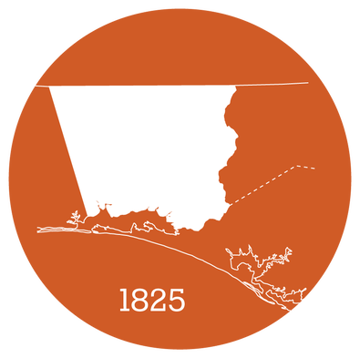
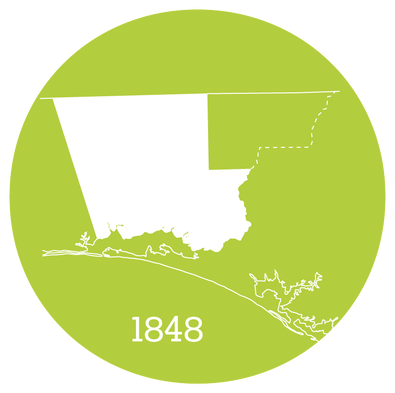
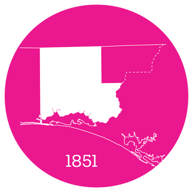
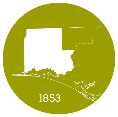
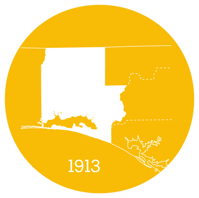
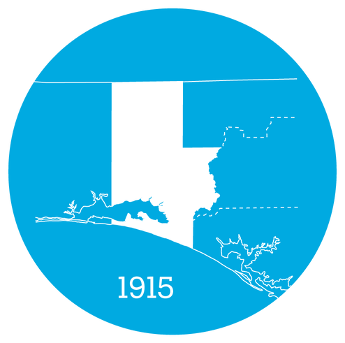
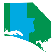
Shaping Walton CountyThe shape of Walton County has changed through the years
More information on each of the shapes of
Walton County
Graphics: Stephen Brinker for Shaping Florida
|
|
Vertical Divider
|
Brenda Rees | Shaping Florida
All photographs by Brenda Rees Unless otherwise credited Copyright: 2004 - 2023 |
Vertical Divider
|

|