Shaping Florida
  • Home
    • About
    • Galleries >
      • Walton's Borders
    • Links
  • Blog
  • Walton County
    • Walton County 200th
    • Shaping Walton County
    • George Walton, Jr
    • Octavia Walton Le Vert
    • "Pappy" Neal McCormick
  • Publications
  • Shaping Florida
    • T.T. Wentworth Jr. Museum
    • Anna's Stories
    • Hendry
    • Eastern Lake
    • John Wesley in Spanish Florida
    • Facebook Series
    • Panama City 100th

Coastal Dune Lake History

6/2/2016

0 Comments

 
Picture
Picture
Picture
Picture
Repost of Earlier Before 30A -- Coastal Dune Lake History to coordinate with this weekends Coastal Dune Lake event at Grayton Beach State Park. 6-2-2016

​Brenda Rees | Shaping Florida

Before 30 A, the Coastal Dune Lakes along South Walton's shoreline had a history, names and flowed free.

 
These unique and globally imperiled treasures have been around in their Coastal Dune Lake status about 3000 years when the land, the sand, and the sea level had stabilized (see my SW History Paper 2006 UWF and Randazzo and Jones "The Geology of Florida" 1997 p 158).  Natives in this area of Florida would have had some great views and vantage points to see encroaching native peoples, European explorers or American opportunists. Picture of dunes and beach between Eastern and Deer lakes by Brenda Rees | Shaping Florida.
 
 
Old maps show traces of the Coastal Dune Lakes, long before 30A cut through them, sometimes like a common ditch with culverts and causeways.  Here's partial view of 1938 Geological Survey shows Morris Lake as Bald Hill Lake in Topsail Hills and Morrison Lake and Horseshoe Lake as smaller lakes to the west. Plenty of older maps show Lake Powell as Lake Ocala. Some called it Phillips Inlet. Four Prong Lake is just over the border in Okaloosa County, area once in original border of Walton County.  Full 1938 map copy from Bob Hurst, did program at Walton County Heritage Association .
 
 
Eastern Lake, a Coastal Dune Lake, has a long history before 30 A.  The Wesleys traveled to their 1903 land grant on Eastern Lake across bridge on north end.  Road was north/south from Pt. Washington to Eastern Lake and nearby Seagrove area (earlier named Russ Hammock after Pt. Washington leader).  The north/south road also went from Pt. Washington to Grayton Beach. Picture of early Eastern Lake Bridge, which existed before 30A, by Brenda Rees | Shaping Florida.  Bob Swinford shared story with me and others how he traveled across this bridge in 1938 to visit his future bride, Mickey Wesley, the ninth and youngest child of William and Katie Wesley of the Wesley House at Eden in Pt. Washington  Friends of Eden Gardens State Park. Picture of Bob Swinford and Brenda Rees from my yard on Eastern Lake looking across to his home, father's beach house, and early Wesley homestead beach cottages. photo (c)  Brenda Rees | Shaping Florida
 
 
Extra info on earlier settlers of Eastern Lake. For those that don't know by memory yet, William and Katie Wesley built "The Wesley House" in 1897 at Eden Gardens State Park in Pt. Washington, Florida. Pt. Washington is one of the earliest communities in Walton County. Roche wrote of trade between Pt. Washington and Vernon in 1822. (See letter of my great step aunt Alline, Mrs. Kenneth "Tuff", Smith)This 1822 date was one year after Florida was US Territory with Jackson as Governor and George Walton, Jr. As Secretary of State of West Florida, and two years before Walton County was formed on December 29, 1824. Original research Brenda Rees / Shaping Florida. William Wesley was one of nine sons of Rev. John Wesley of Pt. Washington, who had 1895 land grant in Pt. Washington signed by President Grover Cleveland {check may be okay with William Wesley’s land grant signed by Theodore Roosevelt}, which explains how one of his 9 sons was named Grover Cleveland Wesley, father of Gene Wesley of Seagrove.  Original research by Brenda Rees | Shaping Florida post 11-3-2013

0 Comments

Tallahassee Meridian -- Lafayette -- Walton

6/1/2016

0 Comments

 
Picture

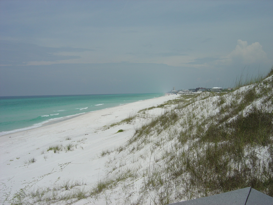
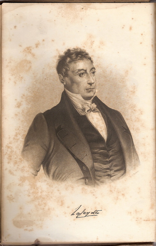
Tallahassee Meridian -- the Marquis de Lafayette -- Walton County, Florida Connections
​Brenda Rees | Shaping Florida post 6-1-2016

All realtors should be familiar with the Tallahassee Meridian -- in longitude 84*16'37.59 west from the prime meridian at Greenwich, runs north and south from the initial point on the base line at Tallahassee, in latitude 30*26'04.12" north . It governs surveys in Florida and Alabama as part of the Public Land Survey System.

​Those interested in Walton County history connections would want to know that Lafayette, who had close ties to the Walton family, had land given to him in gratitude by the United States at the southwest corner of survey monument at Cascade Park near the amphitheater. Lafayette's lands were part of Township 1 North Range 1 East.

There is a street named Walton not far from the Meridian.

​Surveyors and Title Companies should know this mark. Local legend has it that some survey markers have gone missing. Perhaps, they can go back and start from here and make sure due diligence is made that surveys are correct.

​Lafayette fought in the American Revolution with Declaration of Independence signer George Walton. Walton's son, George Walton, Jr. is the namesake for Walton County, Florida. Octavia Walton met with Lafayette in 1825 when he made return trip to America where he was greeted as a great hero.


0 Comments

    Archives

    April 2018
    December 2017
    December 2016
    October 2016
    June 2016
    January 2016
    December 2015

    Categories

    All
    Alaqua
    Cowbellians
    Florida History
    Gardens Florida State Park
    George Walton Jr.
    Hank Williams
    Henry Clay
    Henry Marie Brackenridge
    Mardi Gras
    Mobile
    Naval Live Oak Nature Preserve
    Neal McCormick
    New Orleans
    Octavia Walton Le Vert
    Songwriters
    Walton County
    Wesley House

    RSS Feed

    Sponsors

    Brinker Designs | Residential Design - Graphic Design - Branding
Powered by Create your own unique website with customizable templates.